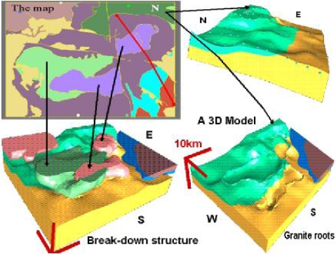
| A new approach to 3D Geological Modelling 3D GeoModeller (Previously called 3DWEG - Web Editeur Géologique) is a 3D geological modelling and geophysical inversion package. 3D GeoModeller is a highly useful tool for environmental, geotechnical, hydrogeology, petroleum and mineral applications, ready for use by exploration geologists, geophysicists, and executives alike! It’s designed to run on a laptop, and be used in the field. Typical projects range from detailed study areas of one kilometre, average dimensions, to 200 kilometre. Current developments are extending the capabilites to cope withhigher data densities and bigger spatial extents. |
 |
|
• The ability to accept primary geological observations to build the 3D geological model • Every model is geologically sensible, adhering to built-in geological rules • As new data becomes available, it can be rapidly incorporated, thus revising the model • Accurately models complex geological settings and elements (overturned fold limbs, complex faults / shear zones, intrusions and basement) • The ability to see geophysical datasets in the context of the geological model, and do forward models to see how they fit these datasets • Uses geophysical datasets to refine the model via inversion approaches (gravity and magnetic survey data) • The inversion process continues after the solution has converged (of observed versus computed parameters) – exploring a wide range of allowable models. • Results are presented in terms of probability movies and voxets. For more information please visit http://www.geomodeller.com |
||