|
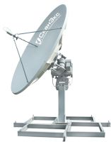
UniScan™-24 ground station is designed for receiving and processing images transmitted from low-orbiting Earth satellites in X-band with data rates up to 320 Mbps in one receiving channel. Such data rate allows transmitting detailed images with the spatial resolution better than 1 meter. |
 |
UniScan™-36 ground station is designed for receiving and processing images transmitted from low-orbiting Earth satellites in X-band with data rates up to 320 Mbps in one receiving channel. Such data rate allows transmitting detailed images with the spatial resolution better than 1 meter. |
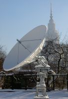 |
Personal receiving stations and terminals are accepted as an antenne system that receives , stores and analyze imageries acquired by earth resource satellites. Find below the common features of these stations if we compare them to traditional systems that observe the Earth from space:
• Reasonable Price• Compact dimension
• Standart PC-based Technology
• Tematic analysis, applications and easy integrated systems for storing data
• Personal Ground Control stations, are the incomparable systems that users can directly download the acquired imageries from earth resource satellites.
We are hoping to see you that after reading this part, you will begin to think of creating your own station even the remote sensing center. This system lets you serve wide range pratical services on most activities like management of natural resources, meteorology and education. For more information please contact us.
Orbital Parameters and Specifications of On-board instrument of NOAA Satellites:
APT Mode is a mode that contains only the two spectral bands of AVHHR (Advanced Very High Resolution Radiometer). Generally it is prefered to use 2. and 4. bands day time and 3B and 4. channels for night imagery. The spatial resolution of the imagery has been decreased from 3.5km/pixel to 1.1km/pixel. So the imagery has unfiorm spatial resolution along the path. The datas are freeware and designed for WMO concept. |
Günlük Veri Alımı Örneği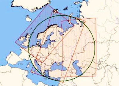 AVHRR- bir uyduya ait günlük veri alım kapsama alanı. Liana™ için gözlem çapı 2,200 km’dir. |
| Basic Specifications of AVHRR sensor (for APT formatted datas): | |||||||||||||||||||||||||||||||||||
|
|||||||||||||||||||||||||||||||||||
| * 24 hours time section for a satellite at average altitude. |
Applications by APT formatted AVHRR Data:
Hydrology, Meteorology and weather forecasts, Monitoring of Glaciers on the seas, Cloud Forecast for weather measurement plans, Education