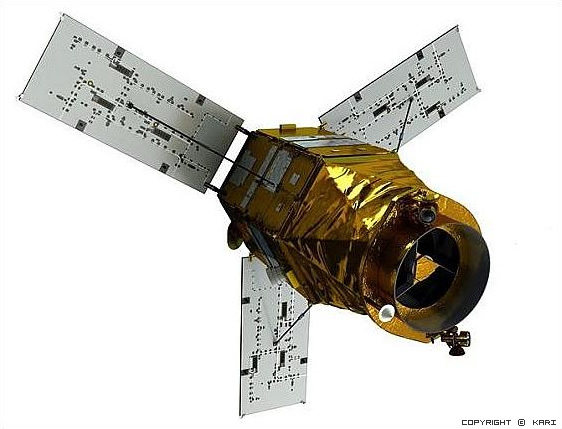
KOMPSat 3 (Korean Multi-purpose Satellite 3) is a lightweight Earth observation satellite developed by the Korea Aerospace Research Institute KARI. It is similar to the KOMPSat 2 spacecraft. The optical component was being developed by Astrium.
It is operating at an altitude of 685 km in a sun-synchronous orbit for 4 years and monitor the Korean peninsula using a payload capable of 70cm. class resolution. The mission objectives of the KOMPSAT-3 are to provide continuous satellite Earth observation after KOMPSat 1 and KOMPSat 2 and to meet the nation‘s needs for high-resolution EO (Electro-Optical) images required for GIS (Geographical Information Systems) and other environmental, agricultural and oceanographic monitoring applications.
For more information: https://www.kari.re.kr/eng/sub03_02_01.do
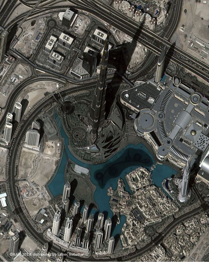
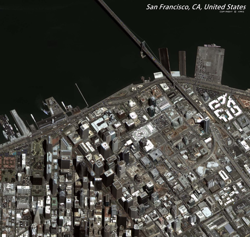
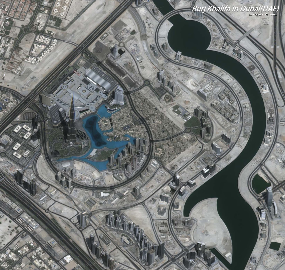
• High Resolution capability: 0.7m PAN & 2.8m MS with 15km swath at nadir.
• Unique local time increases visibility: 13:30 local time
• Data suit by constellation of Optical and Radar: KOMPSat-2 (1m Optical), KOMPSat-3 (0.7m Optical) and KOMPSAT-5 (1m SAR)
• Higher availability comparing with other commercial satellites
• Data continuity guaranteed by long-term government commitment
KOMPSAT-3 satellite orbital parameters
| Orbit type | Circular, sun-synchronous |
| Orbit altitude | 685.13 ± 1 km |
| Inclination | 98.14° ± 0.05° |
| Period | 98,5 min |
| MLTAN | 13:30 +10/-15 min |
| Eccentricity | 0 to 0.001 |
| Ground Sampling Distance | PAN: 0.7m at altitude 685 km (nadir) MS: 2.8m at altitude 685 km (nadir) |
| Swath Width | 15 km (nadir) |
| Spectral Bands | PAN: 450 ~ 900 nm MS1 (Blue): 450 ~ 520 nm MS2 (Green): 520 ~ 600 nm MS3 (Red): 630 ~ 690 nm MS4 (NIR): 760 ~ 900 nm |
| Modulation Transfer Function | System MTF at Nyquist freq. for PAN: 8% System MTF at Nyquist freq. for MS: 12% (at strip imaging mode) |
| Signal to Noise | > 100 |
| Location Accuracy | < 70m CE90 |
KOMPSAT-3 Instrument Performance Parameters
| Band | Spectral band (mkm) | Spatial resolution, m | Dynamic range, bits/pixel | Swath width (km) |
| Panchromatic | 0,45 - 0,90 | 0.7 | 14 | 16 |
| 1: Blue (B) | 0,45 – 0,52 | 2.8 | ||
| 2: Green (G) | 0,52 – 0,60 | |||
| 3: Red (R) | 0,63 – 0,69 | |||
| 4: Near infra-red (NIR) | 0,76 – 0,90 |
- Mapping
- Remote Sensing Applications
- Land Monitoring
- Disaster environment monitoring
 |
 |
 |
 |
 |
 |