
The second generation DMC satellites carry the upgraded 22m gsd SLIM-6 sensor, which provides twice the pixel density per hectare of the first generation DMC 32m gsd sensors. The SSTL built satellites carry the latest technology advances, providing improved image quality, resolution and capacity with new sensors, purpose built optics, enhanced on board data storage, and high capacity X-band downlink.
The satellites are capable of providing very large area coverage with a twenty-fold capacity increase over the first DMC generation.
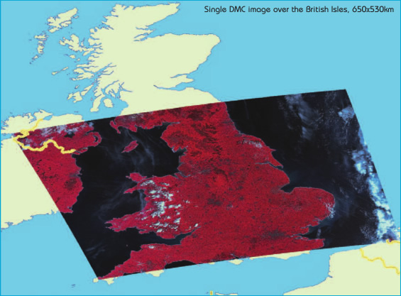
The sensor Linear push-broom sensor built by SSTL Optics Group to acquire a 650km swath with 22m ground sample distance (nadir).
For more information: www.dmcii.com
Techical Specifications:
|
Spatial Resolution 22m 30m
Typical SIgnal-To-Noise >100:1 >100:1
Absolute Radiometry <5% <5%
With respect to Landsat <1%
Gain configurable Fixed
Integration Time Fixed Fixed
Swath 650km 185km
Quantisation 8 or 10 bit 8 bit
programmable
Band: Near IR 0.77 - 0.90 μm 0.77 - 0.90 μm
Band: Red 0.63 - 0.69 μm 0.63 - 0.69 μm
Band: Green 0.52 - 0.60 μm 0.52 - 0.60 μm
Spatial Resolution
|
22m |
| Typical signal-To-Noise | >100:1 |
| Integration Time | Fixed |
| Swath | 650km |
| Radimetric Resolution | 8 or 10 bits |
| Band:Near IR | 0.77-0.90um |
| Band:RED | 0.63-0.69um |
| Band:GREEN | 0.52-0.60um |
DMC data is used for a wide range of applications which benefit from the well-calibrated spectral information, wide swath and rapid revisit capability. These include;
- Agricultural monitoring
- Land cover mapping
- Forest monitoring
- Disaster response
 |