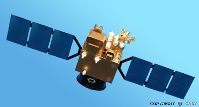
TH-01 Satellite Image TH-01 Satellite information:
TH-01 is the first transmission type satellite of China that can capture triplet stereo image to do surveying and mapping, TH-01 have triplet stereo surveying and mapping camera, high resolution camera, multispectral camera, can collect triple stereo image, high resolution image and multispectral image all over the world, widely used in science research, land rescue research, surveying and mapping. TH-01 launched at Aug 24 2010.
TH-01 Product Type and Level:
TH-01 can provide 2 kinds products: Primary and Senior, total 5 levels:
Primary: Level 1A, Level 2
Senior: Level1B, Level 3A and Level 3B

For more information: http://en.bsei.com.cn/en/home.html
TH-01 Satellite Parameters:
| Sensor | TH-01 |
| Launch Date | 2010-08-24 |
| Mission Life | 3 Years |
| Weight | 1000kg |
| Orbit Altitude | 500km. |
| Strip Width (Nadir) | 60km |
| Pan Resolution | 2m. |
| Multi-Spectral Resolution | 10m. |
| Multi-Spectral wavelength | 0.43um~0.52um 0.52um~0.61um 0.61um~0.69um 0.76um~0.90um |
| Triplet stereo resolution | 5m. |
| Triplet stereo wave length | 0.51um~0.69um |
| Orbit Period | 58 days |
| Revisit time | 5 days |
| Orbit | Sun synchronous |
TH01 Industry Applications
• DEM Mapping
• Mining Applications
• Agriculture Applications
• Forestry Applications
• Urban Mapping Applications
• Disaster Monitoring Applications
• Geography
• Water Vapor / Water Resources
• Oceanic Field
1. DEM Mapping
• Develop automatic producing method of DEM.• Develop automatic producing method of Ortho-image for map data.
• Develop technology for efficient map update.
2. Mining Applications
Geological research and mineral resource exploration using integrated TH01 data into DEM, Ortho-image and data from other satellites.3. Agriculture Applications
Understand and research on the estimation of changes regarding productivity, growth volume and crops on farm or grassland, and planting status of agricultural products.4. Forest Applications
• Productivity and growth of farm, grasslands and forests, tree distribution of forests, planting status of farm products, monitoring and estimation of damage by blights and insects.• Understand forests global mapping to analyze circulation mechanism of carbon and vegetation dynamics that play a major role for global warming.
• Deforestation for urbanization, firewoods and exportation, human activities such as biomass burning, forests fire, and alteration of forests and grasslands due to natural disaster of drought.
5. Urban Mapping Applications
• Develop algorithms for automatic accurate land cover categorization.• Monitor changes of land use and vegetation due to urban and housing development.
6. Disaster Monitoring Applications
• Earthquakes, diastrophism and volcano monitoring.• Forests fire, flooding.
• Landslides, Slope failure, Ground sinking.
• Oil spill due to tanker accidents.
• Anticipation towards the disaster above and monitoring the impacts of the disaster.
7. Geography
• Arrange Geographic Information System (GIS) integrated map data into statistic information.• Study land management to establish arrangement plan and support management for urban facilities such as houses, trains, roads, water services.
• Study on the subject that is deeply related to human residing areas such as environment assessment, monitoring climate change in urban areas including heat island phenomenon.
• Conservation Plan for important heritage.
• Estimation and prevention strategy towards infectious diseases or parasite worm diseases using vegetation status and soil moisture data.
8. Water Vapor / Water Resources
• Develop algorithms for measuring key parameters for water vapor estimation.• Analyze land deformation and flow change due to soil erosion along the river, or accumulation.
• Analyze outflow change utilizing land use, land cover change or DEM.
• Analyze water pollution.
• General water resource management in the areas where there is insufficient available data.
9. Oceanic Field
• Study on waves, monsoon, coastal current and sea ices.
• Figure out ocean dynamics.
• Monitoring land deformation due to coastal erosion and accumulation.
• Monitoring change of distribution and growth status of coral reef.
• Monitoring ocean pollution due to tanker accident or inflows of polluted river water, and study and research the influence on coastal fishery affected by red tide etc.