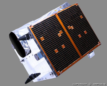
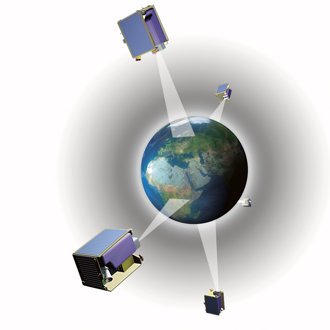
 RapidEye is a provider of quality high-resolution satellite imagery and derived geo-information products. With a constellation of five Earth Observation satellites, RapidEye images over 4 million square kilometers of Earth every day, and amassed over 2 billion square kilometers of imagery in just over two years of commercial operation. With an unprecedented combination of wide area repetitive coverage and five meter pixel size multi-spectral imagery, RapidEye is a natural choice for many industries and government agencies. For more info: www.rapideye.de
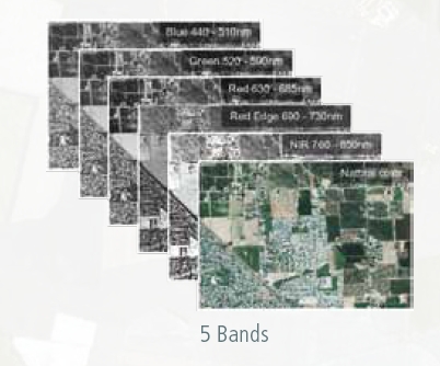
RapidEye’s satellites are the first commercial satellites to offer the Red-Edge band, which measures variances in vegetation, allowing for species separation and monitoring vegetation health.
Rapid Eye Data Formats:
Depending on the task at hand, two different levels of RapidEye Standard Image Products will be commercially available.Atmospheric correction can be applied as an option to either level.
RapidEye Basic Product Level 1B
RapidEye Basic Product is radiometric and sensor corrected, providing imagery as seen from the spacecraft without correction for any geometric distortions inherent in the imaging process, and is not mapped to a cartographic projection. The imagery data is accompanied by all spacecraft telemetry necessary for the processing of the data into a geo-corrected form.
RapidEye Ortho Product Level 3A
RapidEye Ortho Product offers the highest level of processing available. Radiometric, sensor and geometric corrections have been applied to the data. These have been rectified using a DTED Level 1 SRTM DEM or better, and with appropriate ground control can meet an accuracy of 6m 1-sigma (12.7m CE90). The highest accuracy that can be achieved by these products meet 1:25,000 NMAS standards
| Number of Satellites : | 5 | |
| Satellites Life (approx.) : | 7 year | |
| Orbit Height : | 630 km. Sun-synchronous | |
| Equator crossing : | 11:00 am (approx) | |
| Spectral Bands (nm) : | > Blue 440 - 510 nm > Gren 520 - 590 nm > Red 630 - 685 nm > Red Edge 690 - 730 nm > NIR 760 - 850 nm |
 |
| Ground Sampling (nadir) : | 6.5 m | |
| Pixel Size 5 m (orthorectified) : | 5 m. | |
| Swath Width : | 77 km. | |
| Image Capture : | 4 Million km² DAILY Capacity | |
| Revisit Time : | 5.5 days (Nadir) , Everyday (Off-nadir) | |
| Dynamic Range : | 12 bits | |
 |
 |
|
|
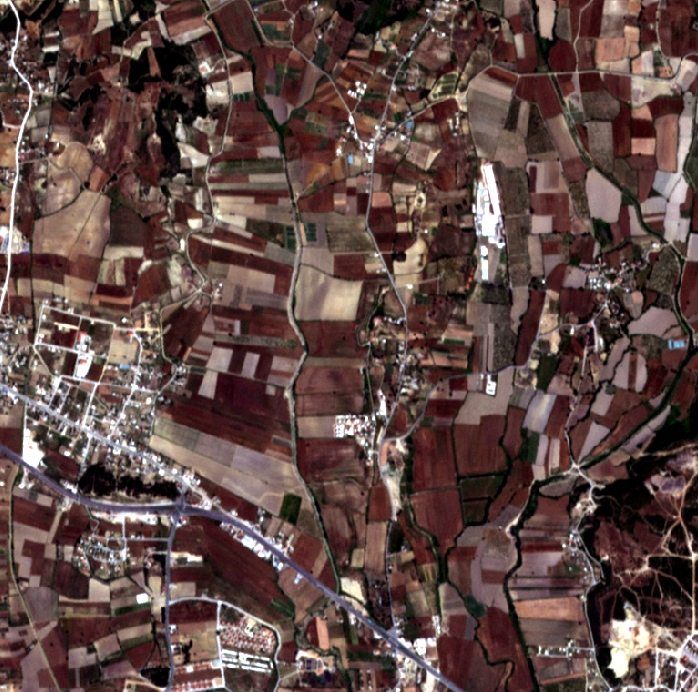
 A detailed part from the image on left |
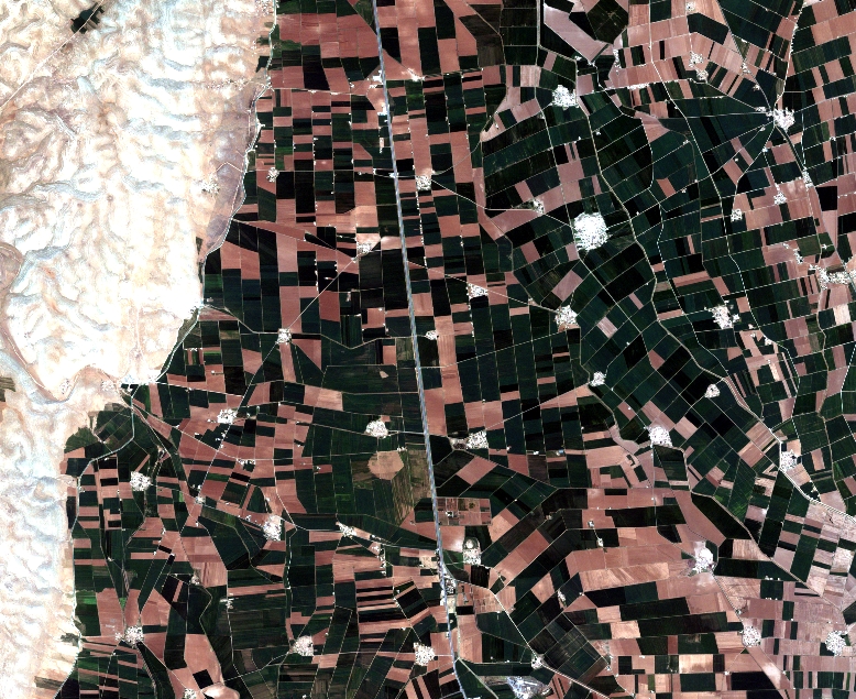
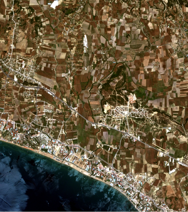 RapidEye - Antalya |
 A detailed part from the image on left |