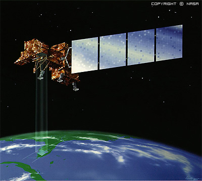
After sending the first LANDSAT satellite to Space, four following LANDSAT satellites were launched for orbit. The first generation consists of three satellites. These satellites were carrying two sensors as RBV and Multispectral Scanner(MSS). Due to the technical issues and the spectral and spatial advantages of MSS, RBV was rarely used.
Second Generation Landsat satellites were donated with Thematic Mapper (TM) instead of RBV instrument beginning from 1982 with Landsat 4. Unfortunately Landsat 6 fell down unluckily in 1993 and after that Landsat 7 was launced that was equipped with Enhanced Thematic Mapper instrument with pancromatic scanner in 1999.
Orbit Characteristics:
Landsat has a sun-syncronous near-polar orbit. It has ability to image between 81°N and 81°S
Landsat-1-3 satellites have the revisit-cycle time as 18 days. This period is 16 days for Landsat 4-5.
The Ground Track Seperation on the equator is 173km, so this gives the satellite 7.6 overlay between the tracks.This overlays gets increase in the poles.
Geographic Coverage Area:
16 days of revisit times of Landsat are the part of WorldWide Reference System (WRS). WRS World Map is a path map designed according to path-row pass ways of Landsat. Besides, Landsat 1,2 and 3 (WRS1) has different coordinate system than Landsat 4 and 5 (WRS2).
Portable receiving stations were used in order to downlink the Landsat 5 TM datas in 1994 and 1995 over Africa (in Nairobi, Kenya,Gabon and Libreville).
Landsat TM and MSS datas are 8bit depth.
Thematic Mapper
Thematic Mapper on Landsat 5 is exactly the sames as the one in Landsat 4. TM has been used since 1994 with 6 bands in NIR and SWIR regions of 30m spatial resolution and one thermal band of 120m spatial resolution.
Instruments on Landsat-7
Landsat 7 has been carrying the instrument called as Enhanced Thematic Mapper(ETM). ETM has additional pancromatic band with 15m spatial resolution. Besides the spatial resolution of thermal bands were decreased to 60m.
It has ability to image even not in the coverage area of the receiving station due to the record unit on board.
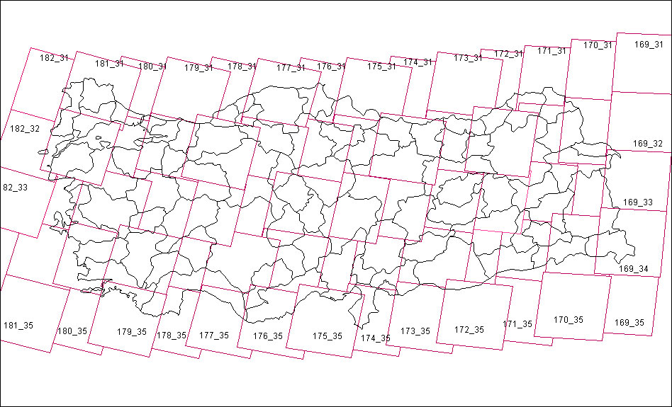
Click for the path-row maps of Landsat 5-7.(Turkey)
For more information: http://landsat.gsfc.nasa.gov/
|
||||||||||||||||||||||||||||||||||
Applications of Landsat Data
Landsat data have been used by government, commercial, industrial, civilian, military, and educational communities throughout the United States and worldwide. The data support a wide range of applications in such areas as global change research, agriculture, forestry, geology, resource management, geography, mapping, water quality, and oceanography.Both Landsats 5 and 7 continue to provide important observations of the Earth. The design of the Landsat 5 satellite, which was launched in 1984, has lasted longer than anticipated and has established a tremendous record for reliability. Landsat 7 continues to provide the global science community with a wealth of data.
As of August 2005, USGS ground stations have collected more than 543,000 scenes for the U.S. archive. This network of ground stations, along with the ability to record data to an onboard solid state recorder, allows virtually complete global coverage.
The consistency of Landsat data over three decades of acquisition offers opportunities to compare land cover changes over time. Landsat images are also invaluable for emergency response and disaster relief. Advances made in data reception and processing permit rapid access to imagery in times of natural or human-made disaster. Within hours of data acquisition, the USGS Center for Earth Resources Observation and Science (EROS) in Sioux Falls, South Dakota, provides relief organizations worldwide with satellite images for disaster response, as well as image-derived products that incorporate information on population density, elevation, and other relevant topics.