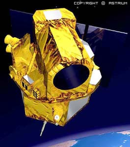
FORMOSAT-2 is a high-resolution optical satellite able to revisit the same point on the globe every day in the same viewing conditions. Its unique orbit and 2-metre resolution are well suited to change detection and rapid coverage of large areas.
The first remote sensing satellite developed by National Space Organization (NSPO), FORMOSAT-2, successfully launched on May 21, 2004 with a high resolution of 2 meter panchromatic data and 8 meter multispectral satellite image data. The main mission of FORMOSAT-2 is to conduct remote sensing imaging over Taiwan and on terrestrial and oceanic regions of the entire earth.
FORMOSAT-2 is a high-resolution optical satellite able to revisit the same point on the globe every day in the same viewing conditions.
Its unique orbit and 2-metre resolution are well suited to change detection and rapid coverage of large areas.
Formosat 2 has been deactivated on 19th August 2016.
For more information: https://www.satimagingcorp.com/satellite-sensors/other-satellite-sensors/formosat-2/
| Products | B&W: 2 m Colour: 2 m (merge) Multispectral (R, G, B, NIR): 8 m Bundle (separate Pan and MS images) |
| Spectral bands | P : 0,45 – 0,90 µm B1 : 0,45 – 0,52 µm (Blue) B2 : 0,52 – 0,60 µm (Green) B3 : 0,63 – 0,69 µm (Red) B4 : 0,76 – 0,90 µm (Near-infrared) |
| Sensor footprint | 24 km x 24 km |
| Revisit rate | Daily |
| Viewing angles | Cross-track and along-track (forward/aft): +/- 45° |
| Pre-processing levels | Level 1A, 2A and Ortho |
FORMOSAT-2 satellite images support monitoring and detecting land change for any specific region for various industries and mapping applications. Users can task the satellite to keep track by scheduling revisits to detect changes on land and infrastructures, to observe movement overtime and helps to keep a current database to know what is happening on the ground so users can make informed decisions.
• Urban Land Utilization Monitoring
• Environment Monitoring and Planning
• Farm Crop Management
• Forest Management and Monitoring
• Disaster Area Evaluation
• Ecological Environment and Resources Research
• Tourism and Traveling
• Defense Mapping
• Coastal Management