All ITRES imagers have been designed for airborne use, based on their pushbroom design. The generation of a recognizable scene image relies on the relative forward movement of the imager in relation to the scene being imaged. Although we have had clients who have utilized our imagers in a ground-based role, the vast majority use aircraft.
Each of our hyperspectral or broadband imagers can be mounted on a variety of platforms, including helicopters. We’ve also had clients use small, single-person planes, as well as airships with our systems.
Our imagers are capable of very high resolution imaging, as low as 10cm pixel sizes in some cases. With airborne imagers such as ours, spatial pixel resolutions are measured in two directions: along-track (in the direction of flight) and across-track (orthogonal to the flight direction). While across-track resolution is a function of flying height above ground and the optical sensor’s field of view, along-track resolution depends on aircraft speed and sensor integration time or frame time. Slower flight equates to smaller pixel sizes and hence, higher image resolution.
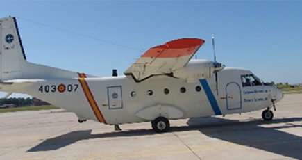
The table below shows a partial list of typical aircraft types that have made successful imaging platforms for our sensors. This list is by no means exhaustive.
| Fixed-Wing Aircraft Hyperspectral Platforms | Helicopter Hyperspectral Platforms |
| • Beechcraft KingAir • Britten-Norman (BN2) Islander • Cessna 310/320 • Cessna 404 • Cessna Citation • Cessna Skymaster • Piper Navajo (PA-34) • P68B (Partenavia Observer) • CASA-212 |
• Bell 206 JetRanger • Bell 206L LongRanger • Hughes 500 • Aerospatiale AS320 |
 |
 |
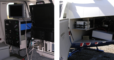
| CASA-212 aircraft used as hyperspectral platform | Helicopter installation of thermal TABI-320 and Lidar |