Hyperspectral & Thermal Mapping Applications
Whether interested in conducting your own hyperspectral and/or thermal surveys or having us collect the data for you, this page provides you with just a few ideas of the range of uses that our high-performance airborne imagers are suitable for.Applications for our sensors are as numerous and varied as the groups and disciplines that employ them. Choosing which optical imager or imagers to use for a given project relies on understanding the general reflective (or emissive, in the case of thermal) characteristics of the surface to be imaged and each spectral region’s different strengths towards differentiating between target types.
Benefits of ITRES
• Their global experience• Knowledgable and reliable staff
• World leading imaging systems in accuracy, sensitivity
and performance
• Itres offers end-to-end services and ongoing support
• Expansive processing and analysis expertise
Example Hyperspectral & Thermal Applications
 |
AGRICULTURE |
 |
ENVIRONMENT |
| • Bare soil, moisture content, growth stage • Chlorophyll/nitrogen content, leaf brown pigment, LAI • Disease, stress mapping • Crop species delineation |
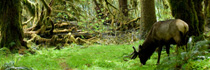
• Change detection, invasive species • Wildlife surveys • Environmental assessments |
||
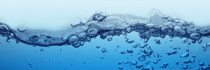 |
WATER QUALITY |
 |
LIDAR, IFSAR |
| • Chlorophyll, total suspended solids • Pollution presence, identity, & distribution • Thermal mixing |
• Image orthorectification • Data visualization/modeling • Hydrology mapping |
||
 |
FORESTRY |
 |
DEFENCE & TARGET DETECTION |
| • Yield inventory • Stem counts/density/canopy closure • Disease management/mapping |
• Surface and buried landmine detection • Unexploded ordnance (UXO) |
||
 |
WETLANDS MAPPING |
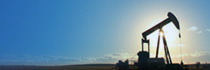 |
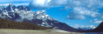
GEOLOGY, MINING, OIL & GAS EXPLORATION |
| • Benthic cover/submerged aquatic vegetation • Near-shore vegetation mapping, algae • Land/water interface |
• Pipeline corridor mapping • Buried pipeline delineation/pipeline leakage • Mineral composition • Stratigraphy, structural geology |
||
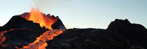 |
THERMAL ANOMALIES |
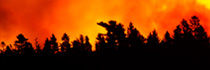 |
EMERGENCY RESPONSE |
|
• Building/infrastructure heat loss mapping |
• Oil slick mapping • Forest fire thermal mapping • Sea/land search and rescue |
||