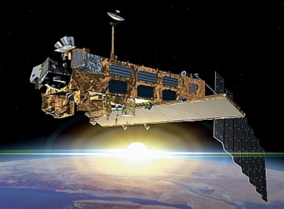
In March 2002, the European Space Agency launched Envisat, an advanced polar-orbiting Earth observation satellite which provides measurements of the atmosphere, ocean, land, and ice.
The Envisat satellite has an ambitious and innovative payload that will ensure the continuity of the data measurements of the ESA ERS satellites. Envisat data supports earth science research and allows monitoring of the evolution of environmental and climatic changes. Furthermore, the data will facilitate the development of operational and commercial applications.
Sensors on board: MERIS, ASAR, AATSR, RA-2, MWR, DORIS, GOMOS, MIPAS, LRR SCIAMACHY
ASAR (Advanced Synthetic Aperture Radar)
An Advanced Synthetic Aperture Radar (ASAR), operating at C-band, ASAR ensures continuity with the image mode (SAR) and the wave mode of the ERS-1/2 AMI. It features enhanced capability in terms of coverage, range of incidence angles, polarisation, and modes of operation. This enhanced capability is provided by significant differences in the instrument design: a full active array antenna equipped with distributed transmit/receive modules which provides distinct transmit and receive beams, a digital waveform generation for pulse chirp generation, a block adaptive quantisation scheme, and a ScanSAR mode of operation by beam scanning in elevation.
DORIS (Doppler Orbitography and Radiopositioning Integrated by Satellite)
DORIS is a tracking system providing range-rate measurements of signals from a dense network of ground-based beacons. These data are precision processed on ground providing the satellite orbit with an accuracy of the order of centimetres. They are also processed on board to provide real time satellite positions with an accuracy of some tens of centimeters. In addition to enabling orbit determination, data are provided to: help in the understanding of the dynamics of the solid Earth; monitor glaciers, landslides and volcanoes; improve the modeling of the Earth gravity field and of the ionosphere.
GOMOS (Global Ozone Monitoring by Occultation of Stars)
The Global Ozone Monitoring by Occultation of Stars (GOMOS) Instrument on board Envisat is the newest ESA instrument aiming at ozone monitoring. It is a tool to provide altitude-resolved global ozone mapping and trend monitoring with very high accuracy, as needed for the understanding of ozone chemistry and for model validation. The primary GOMOS mission objectives are:
Measurement of profiles of ozone, NO2, NO3, OClO, temperature, and water vapor;
Day- and night-side measurement capability;
Global coverage with typically over 600 profile measurements per day;
Altitude measurement capability between the tropopause and 100 km;
Altitude resolution of better than 1.7 km.
MERIS (MEdium Resolution Image Spectrometer Instrument)
The MEdium Resolution Imaging Specrometer Instrument MERIS measures the solar radiation reflected by the Earth, at a ground spatial resolution of 300m, in 15 spectral bands, programmable in width and position, in the visible and near infra-red. MERIS allows global coverage of the Earth in 3 days.
The primary mission of MERIS is the measurement of sea colour in the oceans and in coastal areas. Knowledge of the sea colour can be converted into a measurement of chlorophyll pigment concentration, suspended sediment concentration and of aerosol loads over the marine domain.
Why measure ocean colour?
Four broad domains of applications of ocean-colour data can be identified:
the ocean carbon cycle
the thermal regime of the upper ocean
the management of fisheries
the management of coastal zones
MIPAS (Michelson Interferometer for Passive Atmospheric Sounding)
The Michelson Interferometer for Passive Atmospheric Sounding (MIPAS) is a Fourier transform spectrometer for the measurement of high-resolution gaseous emission spectra at the Earth»s limb. It operates in the near to mid infrared where many of the atmospheric trace-gases playing a major role in atmospheric chemistry have important emission features.
The objectives of MIPAS are:
Simultaneous and global measurements of geophysical parameters in the middle atmosphere;
Stratospheric chemistry: O3, H2O, CH4, N2O, and HNO3; and Climatology:
Temperature, CH4, N2O, O3;
Study of chemical composition, dynamics, and radiation budget of the middle atmosphere;
Monitoring of stratospheric O3 and CFC»s.
MWR (MicroWave Radiometer)
The main objective of the MicroWave Radiometer is the measurement of the integrated atmospheric water vapour column and cloud liquid water content, as correction terms for the radar altimeter signal. In addition, MWR measurement data are useful for the determination of surface emissivity and soil moisture over land, for surface energy budget investigations to support atmospheric studies, and for ice characterization.
RA-2 (Radar Altimeter 2)
The Radar Altimeter 2 (RA-2) is an instrument for determining the two-way delay of the radar echo from the Earth»s surface to a very high precision: less than a nanosecond. It also measures the power and the shape of the reflected radar pulses.
Operating over oceans, its measurements are used to determine the ocean topography, thus supporting the research of ocean circulation, bathymetry and marine geoid characteristics. Furthermore, the RA-2 is able to map and monitor sea ice, polar ice sheets, and most land surfaces. Measurement of the radar echo power and shape enables the determination of wind speed and significant wave height at sea, thus supporting weather and sea state forecasting.
For more information:https://earth.esa.int/web/guest/missions/esa-operational-eo-missions/envisat
ENVISAT Meris Technical Preferences:
|
|||||||||||||||||||||
Envisat Meris Products: |
|||||||||||||||||||||
|
|||||||||||||||||||||
|
Atmosphere |
||||||||||
|
ASAR |
GOMOS |
RA-2 |
MERIS |
MIPAS |
MWR |
LR |
SCIA |
AATSR |
DORIS |
|
|
Clouds |
|
|
|
x |
x |
|
|
x |
x |
|
|
Water Vapour |
|
x |
|
x |
x |
x |
|
|
x |
|
|
Radiation Budget |
|
(x) |
|
x |
(x) |
x |
|
(x) |
x |
|
|
Temperature & Pressure |
|
x |
|
x |
x |
|
|
x |
|
|
|
Trace Gases |
|
x |
|
|
x |
|
|
x |
|
|
|
Aerosols |
|
x |
|
x |
x |
|
|
x |
x |
|
|
Turbulence |
|
x |
|
|
|
|
|
|
|
|
|
Land |
||||||||||
|
ASAR |
GOMOS |
RA-2 |
MERIS |
MIPAS |
MWR |
LR |
SCIA |
AATSR |
DORIS |
|
|
Surface |
|
|
|
|
|
(x) |
|
|
(x) |
|
|
Vegetation |
x |
|
|
x |
|
|
|
|
x |
|
|
Agriculture and |
x |
|
|
(x) |
|
|
|
|
(x) |
|
|
Surface Elevation |
x |
|
x |
|
|
|
x |
|
x |
x |
|
Geology and |
x |
|
(x) |
|
|
|
|
|
x |
|
|
Hydrology Parameters |
x |
|
(x) |
x |
|
(x) |
|
|
x |
|
|
Flooding |
x |
|
|
|
|
|
|
|
|
|
|
Fire |
|
|
|
|
|
|
|
|
x |
|
|
Ocean |
||||||||||
|
ASAR |
GOMOS |
RA-2 |
MERIS |
MIPAS |
MWR |
LR |
SCIA |
AATSR |
DORIS |
|
|
Ocean Colour |
|
|
|
x |
|
|
|
|
|
|
|
Sea Surface |
|
|
|
|
|
|
|
|
x |
|
|
Surface |
|
|
x |
|
|
|
x |
|
|
x |
|
Turbidity |
|
|
|
x |
|
|
|
|
|
|
|
Wave Characteristics |
x |
|
x |
|
|
|
|
|
|
|
|
Near Surface Wind |
x |
|
x |
|
|
|
|
|
|
|
|
Current Features |
x |
|
x |
|
|
|
|
|
|
|
|
Marine Geoid |
|
|
x |
|
|
|
|
|
|
|
|
Global Circulation |
|
|
x |
|
|
|
|
|
x |
|
|
Ocean Fronts |
x |
|
|
x |
|
|
|
|
(x) |
|
|
Coastal Dynamics |
x |
|
|
x |
|
|
|
|
|
|
|
Oil Spill |
x |
|
|
|
|
|
|
|
|
|
|
Natural Film |
x |
|
|
|
|
|
|
|
|
|
|
Ship Traffic |
x |
|
|
|
|
|
|
|
|
|
|
Ice |
||||||||||
|
ASAR |
GOMOS |
RA-2 |
MERIS |
MIPAS |
MWR |
LR |
SCIA |
AATSR |
DORIS |
|
|
Sea Ice Mapping |
x |
|
x |
x |
|
(x) |
|
|
|
|
|
Sea Ice Motion |
x |
|
x |
x |
|
|
|
|
|
|
|
Sea Ice Processes |
x |
|
|
|
|
|
|
|
|
|
|
Ship Routing |
x |
|
|
|
|
|
|
|
|
|
|
Temperature |
|
|
|
|
|
|
|
|
x |
|
|
Snow Cover |
x |
|
|
x |
|
|
|
|
x |
|
|
Topography |
x |
|
x |
|
|
|
x |
|
|
x |
|
Ice Sheet Dynamic |
x |
|
x |
x |
|
(x) |
|
|
|
|