DEIMOS-1 satellite, a SSTL-100 platform designed by SSTL, was successfully launched on the 29th of July 2009, from the Baikonur Rocket (Kazakhstan). DEIMOS-1 mission, fully owned and operated by DEIMOS Imaging S.L. (DMI) offers a new source of geospatial information for medium resolution satellite imagery users around the World.
DEIMOS-1 satellite provides Standard Image Products in Multispectral mode at a resolution of 22 metres with an image swath of up to 600km. Scenes are delivered in level 3 (orthorectified product) as a standard and raw data can be delivered on request.
DEIMOS-1 offers a range of archive images or access to standard and priority programming collections.
Standard Image Product Specifications: 
Mode and Resolution Multispectral - 22 m (GSD)
Spectral Bands NIR: 0,77 – 0,90 µm
RED : 0.63 – 0.69 µm
GREEN : 0.52 – 0.60 µm
Swath Width Up to 600 km (8 or 10 bits)
Swath Length Up to 1000 km
Revisit interval 2 to 3 days
Viewing angles Nadir Acquisitions (up to 12°)
Some background of the DMC constellation:
|
|
DMC Constellation Generation |
|
|
2003 |
DMC-1 |
First generation with 32 m GSD m/s & 600 km wide swath (4 m GSD pan on Beijing-1), in orbit since 2003 |
|
2009 |
DMC-2 |
Current generation providing 650 km wide-swath, 22 m GSD, in orbit since mid-2009 (Deimos-1, UK-DMC-2); 2.5 m GSD pan; NigeriaSat-2 and NigeriaSat-X were launched on August 17, 2011. |
|
2014 |
DMC-3 |
Next generation VHR constellation of 3 satellites with ~1 m GSD pan and 4 m MS data on a 20 km swath |
|
2015 |
DMC-4 |
Hyperspectral imaging.Not Activated |
|
2016 |
DMC-5 |
SAR (Synthetic Aperture Radar) mission to provide all-weather, day-&-night coverage Not Activated |
For more information: https://directory.eoportal.org/web/eoportal/satellite-missions/d/deimos-1
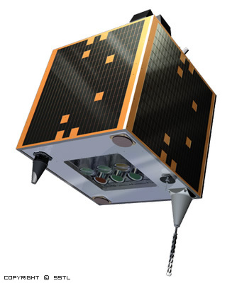
| Platform: | MicroSat-100 bus |
| Sensors: | SLIM-6: 6 channels CCD |
| Nominal orbit: | 680 km |
| Mass: | 110 kg (micro satellite) |
| Dimensions: | 63.2 cm x 63.2 cm x 108.5 cm |
| Orbital period: | 1 h 37 min 56 sec |
| Perigee: | ≈ 642 km |
| Apogee: | ≈ 680 km |
| Inclination: | ≈ 98.13 degrees |
| LTAN (Local Time at Ascending Node): | 10:30 UTC |
| Orbit type: | Polar, sun synchronous |
| Swath: | Up to 600 km (8 or 10 bits) |
| Excentricity: | 0.002 |
| On board storage: | 8 GB |
| Pointing: | Nadir |
| Radiometric resolution: | 8 bits : 0-255 / 10 bits : 0-1023 |
Farming Sector
• Watering Planning Support
• Monitoring of underground water extraction
• Drought Monitoring and assesment
• Hail and Frost Damage assesment
• Crop Conditions
• Qualitive and Quantative analysis
Forestry Sector
• Danger Analysis based on the vegetation conditions
• Fire Detection and monitoring
• Forest Illnesses monitoring
• Estimation of forest cover fraction
Envirionment
• Land Use and cover Maps
• Spill Detection and monitoring
• Flood Area Mapping
• Watershed snow cover assesment
• Water Quality