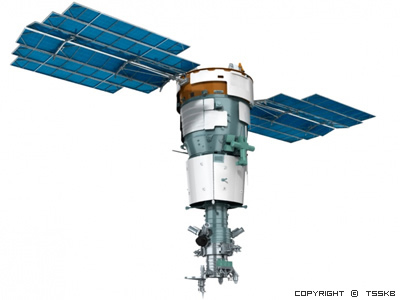
The Resurs-P Earth obersvation satellite will be the succcessor of the Resurs-DK satellite.Depending on the specific application Resurs-P satellite will be operated in the sun-synchronos orbit with the orbit inclination of 97.3degree and 500km altitude. The satellite can produce earth surface digital images with the spatial resolution not worse than 1m in pancromatic mode (one band) and 3-4m in multispectral mode(five bands).The satellite estimated service life is about 5 years.
Unlike the previous version of satellite Resurs-DK, Resurs-P have additional sensors. There are Hyperspectral equipment (96 bands) with spatial resoluiton 25-30m, 25km swath and Ultrawide multispectral sensor with 12-120m spatial resolution, 97-441km swath. Resurs-P will be also able to collect stereo imagery as well as long route areas.
The satellite capacity in pancromatic mode is up to 320.000sq. km per day.
For more information: https://directory.eoportal.org/web/eoportal/satellite-missions/r/resurs-p
| Spatial Resolution | 1m Panchromatic 3-4m Multispectral |
| Spectral Bands | Panchromatic: 580-800nm Blue: 450-520nm Green: 520-600nm Red: 610-680nm Red Edge:720-800nm Near Infrared: 800-900nm |
| Dynamic Range | 10 bits per pixel |
| Revisit Frequency | 3-5 days |
| Swath width | 38km |
| Additional Sensors | Hyperspectral (96 bands),25m resolution and 30km swath width Ultrawide (swath 97-441m),12-120m resolution and 5 bands(Pan+MS) |
| Viewing Angle | ±30degree |
• Forestry
• Agriculture
• Environmental protection
• Making Topographical Maps
• Monitoring of transport communication
• Geology and Oil and Gas applications