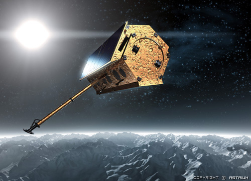
 TerraSAR-X is a new German radar satellite that has been launched on June 15, 2007. The scheduled lifetime is 5 years. It carries a high frequency X-band SAR sensor that can be operated in different modes (resolutions) and polarization. TerraSAR-X will offer features that were not available from space before. The mission’s objectives are:
• The provision of high-quality, multi-mode X-band SAR-data for scientific research and applications as well as
• The establishment of a commercial EO-market and to develop a sustainable EO-service business, based on TerraSAR-X derived information products.
 The mission is realized in a Public Private Partnership (PPP) between the German Ministry of Education and Science (BMBF), the German Aerospace Center (DLR) and the Astrium GmbH.
DLR has implemented the satellite control system and the payload ground segment for receiving, processing, archiving and distribution of the X-band SAR data. DLR is also responsible for the instrument calibration, the 5 years of operation and the scientific use of the TerraSAR-X data.
Under DLR contract Astrium developed and built the satellite. Furthermore Astrium set up a distribution system for the commercial use of the TerraSAR-X data and products. Distribution and value adding will be the task of the Infoterra GmbH.
For more information:http://www.astrium-geo.com/terrasar-x/
|
Active phased array:
|
X-band SAR |
|
Polarisation:
|
Single,dual and quad |
|
Orbit:
|
Sun-synchronous dawn-dusk repeat orbit |
|
Orbit Altitude:
|
512 to 530 km |
|
Revisit time:
|
11 days, due to swath overlay a 2.5 day revisit time can be achieved |
|
Spatial Resolution:
|
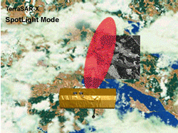
SpotLight HS Mode: 1m resolution @ 300 MHz, 2m resolution @ 150Mhz with a 5 x 5 km scene size |
| SpotLight Regular Mode: up to 1m resolution, 10 km (width) x 5 km (length) | |
| StripMap: up to 3m resolution, 30 km (width) x 50 km (length) | |
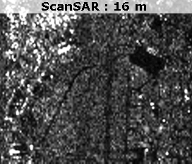
| ScanSAR: up to 18 m resolution, 100 km (width) x 150 km (length |