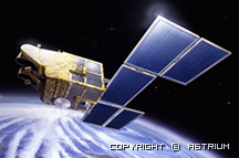
- High resolution 10m. pancromatic(black-white) and 20m. multispectral imagery modes
- Spectral bands for different purposes; stereo capability in flight direction and DEM data and relief maps;
- Beter revisit time; possibility to image the 60kmx60km area in an area of 900km2 in every visit time;
- Capability to program the satellite ;viewing any part of the world in any given time frequently
- Rich imagery archieve over 6 million imageries;
- Seamless servicing capabilitiy via Spot 4 and Spot 5 till the next century
- SWIR band capability
- High resolution and HRVIR instrument
- Vegetation instrument on board.
For more information:http://www.astrium-geo.com/en/4388-spot-1-to-spot-5-satellite-images
|
|||||||||||||||||||||||||||||||||||||||||||||||||||||||||||||||||||||||||
Spot Products |
|||||||||||||||||||||||||||||||||||||||||||||||||||||||||||||||||||||||||
|
|||||||||||||||||||||||||||||||||||||||||||||||||||||||||||||||||||||||||
