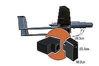
PORTABLE BROADBAND MICRO-TIR IMAGER FOR AIR & GROUND USE
- Portable Air/Ground Broadband TIR Imager (3.7–4.8μm)
- 26.99 x 21.73° FOV, 640 Spatial Imaging Pixels
- Custom Fore-Optics Available
- High Thermal Resolution
- Wide Speed Range, Ultra-High Spatial Resolution
- Internal Blackbody Calibration Source
- Optional GPS/IMU
- Easy Lidar Integration
- Remote Operation via R/F Link or Autonomous via Waypoints
- Precision Data Time Stamping to External Devices
- API Avaiable
Portable Air/Ground Broadband TIR Imager (3.7–4.8μm)
26.99 x 21.73° FOV, 640 Spatial Imaging Pixels
Custom Fore-Optics Available
High Thermal Resolution
Wide Speed Range, Ultra-High Spatial Resolution
Internal Blackbody Calibration Source
Optional GPS/IMU
Easy Lidar Integration
Remote Operation via R/F Link or Autonomous via Waypoints
Precision Data Time Stamping to External Devices
AP
APPLICATIONS:
- Wildfire Mapping
- Building Heat Loss
- Emergency Response
- Power Line Mapping
- Soil Moisture
- Wildlife Surveys
- Soil Moisture
- Subsurface Karst Feature Detection
- Buried Pipeline Delineation
- Hotspot Mapping
- Vulcanology
- Rapid Urban Thermal Mapping
TECHNICAL SPECIFICATIONS:
